NEWS19 December 2018
As part of its ongoing strategy to use new technologies to help identify and fix water leaks, Severn Trent has recently completed a successful trial with research park tenant Earth-i, a provider of high-resolution image data services.
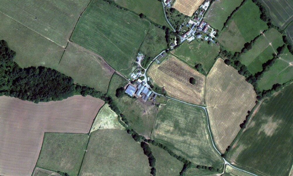
During the UK’s hot summer, Earth-i conducted analysis on imagery captured by British built satellites orbiting at 650km above the Earth. Images were taken of land across Severn Trent’s supply area – approximately 20,000 km2.
Earth-i processed and analysed the high-resolution imagery using a technique known as Normalised Difference Vegetation Index (NDVI) analysis, cross-referencing against the location of the water pipelines.
Paul Majmader, Commercial Director at Earth-i, said, “Working closely on this trial with Severn Trent has produced excellent results. There has been significant interest across the water industry where we are actively engaging in numerous projects to help other companies quickly detect leaks in the pipeline network. These projects benefit not only the water companies but all of us as water consumers. It’s a great demonstration of the sort of everyday challenges that imagery from space can help tackle.”
This is the first time that Severn Trent has commissioned the use of imagery analysis with very high-resolution optical satellites to help identify leaks in a range of circumstances, including leaks that might be hidden far underground or in more remote areas.
Photo: copyright 21AT/Earth-i

See how Surrey Research Park could support your next stage of growth.
Share your details below and we will be in touch to explain more about how Surrey Research Park could support your strategic priorities.